Now sure as to the route of the upcoming MS Walk Birmingham, I emailed the MS Society events people and this morning received a link to a google map of the routes.
There are three distance, one, five and ten kilometres or, as I am doing, a combined Triple Challenge of sixteen.
Looking at the google map, the three courses are shown as 1.43, 4.58 and 9.99. Not exact amounts but adding them all together gives exactly sixteen kilometres.
Below are the map and a short description of each leg.
All start and finish at the City Centre Gardens behind the Library.
1K
A short loop past the front of the Library and onto the canal heading towards the SeaLife Centre.
Right at the junction to Farmers’ Bridge (just past The Flapper). Over the bridge then on footpaths back to the park and the finish.

5K
To the Hall of Memory then on to the Town Hall. Along Colmore Row to The Cathedral. Through Pigeon Park along side Rackhams (House of Fraser). Right onto Corporation Street then left onto New Street and continue on to St. Martins in the Bullring.
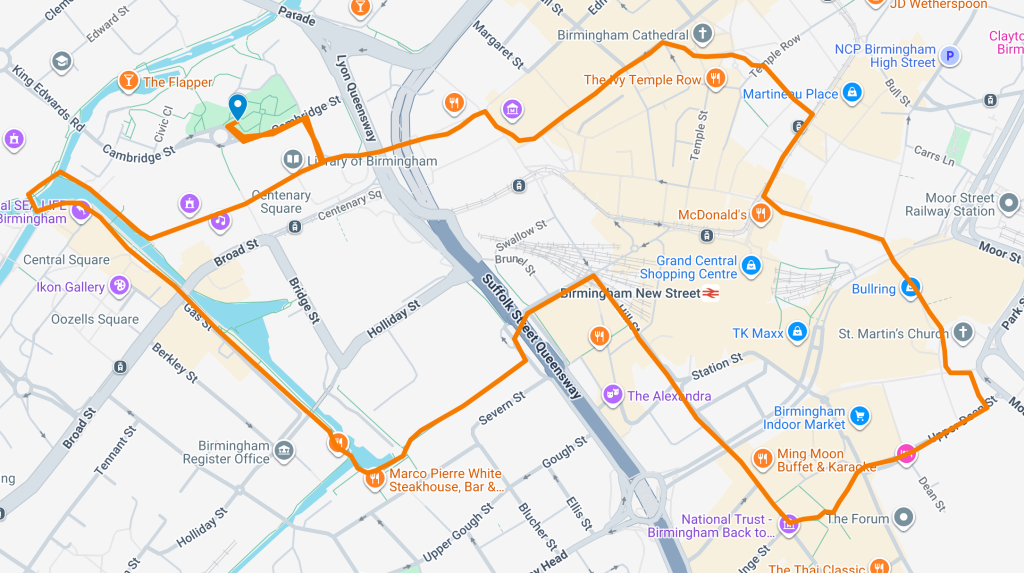
Through the Chinese Quarter to Hurst Street then continue to Hill Street. At Navigation Street, turn left to The MailBox and onto the canal.
Past Gas Street Basin and on to The Sealife Centre. Cross over the canal and head back to the ICC (Symphony Hall), Library and back to the Finish.
10K
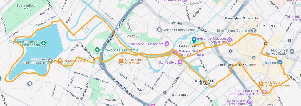
As the 5K course (above) but at the Sealife Centre, turn left and continue along the Birmingham Canal Old Line to Rotten Park Street. Along this road to Ickneld Port Road. A right and left will take us to Edgbaston Reservoir. Anti-clockwise around the ressa to the site of the old Tower Ballroom.
Follow the footpath to cross under Ladywood Middleway and onto to Great Tindal Street and rejoin the canal at St. Vincent Street. Turn right, passing the Lego Centre before re-joining the 5K route.